Reading Time: 6 minutes
Efficient transport networks form the backbone of a thriving economy, making transportation planning essential. Planners must consider its impact on the environment, society, and road users. Roads can transform communities and economies. This post explores the inner workings of our country’s extensive transportation networks.
Just how many lane miles do we have?
Can you imagine what it was like, before 1900? Four percent of the roads in the USA were paved. Today, we have approximately four million miles and 8.3 million lane miles. 1.2 miles of road per square mile of land area is much less than in other developed countries.
According to the U.S. Transportation Department, 68% of the country’s total lane-miles are in rural areas, where 19% of Americans reside.
- Urban areas provide 1,052 lane miles to cater to every 100,000 people.
- Rural areas provide 9,819 lane miles per 100,000 people.
Transportation planning rarely crosses the minds of the average individual; after all, roads and other modes of transport seem to just be where we need them to be without us having to put much thought or effort into it at all.
But behind the scenes, manufacturers, logistics companies, and merchandisers (to name but a few) are working hard to ensure that our lives flow as easily and uninterrupted as possible.
Interested in the connections between transportation and globalization? Discover how advancements in transport are making the world smaller and economies stronger, and what this means for the future of global trade. Explore the full story here: The Impact of Transportation on Globalization.
Planning is Key
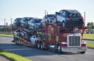
Transportation planning starts before your new luxury vehicle is manufactured in Germany. It is rolled onto a RO/RO shipping vessel and delivered to your door in the United States. That’s just one way in which transportation planning has evolved to be more inclusive.
[Read our Starter Story to learn how transportation planning led to the start of Nationwide Auto Transportation.]

What is Transportation Planning?
Transportation planning examines how humans, land, and activities interact. It focuses on both the economy and organization. In modern times, this planning is a complex task, involving a collaboration among various stakeholders and technologically advanced infrastructures. The goals of transportation planning are:
- Firstly, to predict future outcomes and prepare for possible contingencies.
- Secondly, to create a vision for the future, shaped by present actions.
Building roads has long-term impacts and involves significant costs. Thus, making informed decisions is crucial. For instance, to form a network, roads from different counties must connect at the county line.
Landowners rightfully expect services from both private and public infrastructures. Planning ensures ethical and efficient land use and regulation.
Where it all started
Let’s take a fun ride back to where it all began! Picture this: it’s around 4000 BC, and the world just got its first street paving. But before sleek roads, our ancestors relied on pack animals like donkeys, horses, and oxen for getting around. Imagine traveling on sleds and travois! Then came the cool two-wheel carts in Mesopotamia, and around 3000 BC, folks in northern Iran were cruising in two-wheel chariots pulled by onagers.
Fast forward to 2500 BC, and voila! The first hefty four-wheeled wagons hauled by oxen hit the scene, followed by snazzy two-wheeled chariots with spoked wheels. About five centuries later, horse-haulage entered the chat, all thanks to some nifty primitive harnesses.
With wheels rolling, transportation planning became a thing. Roads needed to be just right – smooth enough for a pleasant ride but tough enough to handle all those wheels, especially when it rained. Timber logs were the go-to road material, later swapped out for brick paving. From one to another, transportation infrastructure kept evolving, leading up to the first tar paved roads in Baghdad, Iraq in the 8th century. Talk about a game-changer!
Then came the industrial revolution, and things really started to zoom! It spurred rapid growth in transportation and cities, taking us from simple, lonely paths to a massive, interconnected global transportation network. What a journey from donkeys to highways! 🐴🚗🌍

But how does it all happen? What are the steps that lead to transportation development? Let’s talk about it.
Road Planning: The Process
- Data collection
The initial phase of transport development involves surveying available data on transportation. It might include information on:
- Land use data
- Population data
- Available transportation
- Intensity and nature of traffic
- Costs and benefits, and
- Freight structure.
Those in charge of the data collection must understand traffic patterns and flows within the area in question. Of course, collecting data on the existing travel patterns can be time consuming.
- Transportation Model
During the second phase of transportation planning, planners use the data collected during the initial stage to build a transport model, which is used to predict future transport network requirements. Important factors that are considered at this time, include:
- Trip generation – Reasons for travel to one or more destinations.
- Trip distribution – This involves the analysis of trips between different zones.
- Traffic assignment – After defining the transport network, future traffic is assigned to assess any deficiencies in existing infrastructure, and the information is used to determine the priorities of the new construction.
Logistics and transportation planning
Finally, a transportation model split study will be done. At this point in transportation planning, planners describe this as the phase during which a mode of travel is incorporated into the model.
- Travel Demand and Future Land Use
In step 3, planners forecast any future land use – long and short term. Most transportation planners work up between five to twenty-five years ahead. As such, their estimates would include:
- Population distribution, size and age;
- Employment, because the work commute is one of the biggest travel demands.

These variables influence the level of future travel demand. Economic variables and population are important when it comes to forecasting future travel demands.
- Evaluation of other alternative policies
During the final phase of transportation planning, planners evaluate alternative suggestions and calculate the costs of the various options suggested by additional planners.
Transport Planning and Regulation | The role of the Transit Department
Several organizations work together and transportation planning, which is an important function in a community, region, state and nation as a whole. These organizations have to collaborate on the evaluation of diverse viewpoints, and participate with relevant transportation organizations and agencies. At times, these departments will request public involvement, as these individuals who are part of the general traveling public, businesses and freight operators will be using the road infrastructures.
The State Department of Transportation, Metropolitan Planning Organization and transit providers collaborate on transportation planning in urban areas, whereas the state and local officials carry out the same in rural areas.
Federally required planning in metro areas is jointly administered by the FHWA and FTA. The regulations for metropolitan areas are set forth in 23 U.S.C. 134 and 9 U.S.C. 5303, whereas the rural statutory provisions are found in 23 U.S.C. 135 and 49 U.S.C. 5304.
Transportation planning has developed significantly over the years to include not only road and rail, but also air and sea transport. New transportation policies are implemented all the time to improve the user experience.
These days, companies like Amazon use drones to deliver packages, and Tesla’s cyber trucks are set to lead the latest in transportation planning.
For now, you can rely on Nationwide for all your auto transportation planning and fulfillment.
Ready to Shift Gears on Your Freight Planning Needs?
In the ever-evolving landscape of transport planning and regulation, one thing remains constant: the need for reliable and efficient auto transportation. Whether you’re a member of the military seeking specialized transport solutions, in need of expedited same-day car shipping, or looking for expert handling of different car types—Nationwide Auto Transportation has got you covered.
Don’t let the complexities of transportation planning slow you down. Our tailored services ensure that your vehicle’s journey is smooth from start to finish. Embrace the future of transport with the assurance that Nationwide is here to navigate the regulations and streamline your experience.
Take the first step towards seamless auto transport. Get a quote today!
Explore our range of services:
- Military Auto Transport: Dedicated services for our service members.
- Same-Day Car Shipping: Because sometimes, tomorrow is too late.
- Car Types We Handle: Comprehensive care for every car.
- Car Shipping Services: Trusted, safe, and on-time delivery.
Contact Nationwide Auto Transportation now and join the ranks of satisfied customers who have experienced the pinnacle of auto transportation planning and fulfillment.


